

For almost 100 millennia when vast amounts of seawater was tied up as continental ice sheets across the northern hemisphere, the coast of Southeast Asia extended hundreds or even thousands of km farther out to sea than it is now, stretching across what’s now the maritime continent toward Australia. Seas rapidly rose hundreds of feet starting 18,000 years ago and flooded early settlements throughout the region, creating relatively narrow peninsulas with inundated coasts.
The highest terrain on Earth – the Tibetan Plateau, Himalayas, and related ranges – was formed when India slammed into Asia 50 million years ago. The forbidding mountain ranges covered with glacial ice formed a semipermeable barrier between two of the biggest and most developed human civilizations – China and India — for millennia.
This high terrain is not far from the Warm Pool of the tropical West Pacific and Indian Ocean, which is an area of water bigger than Russia whose surface temperature is above 30 C (84 F)! There is nowhere else on the planet with such an enormous source of heat so close to such high terrain.
The Asian Monsoon results from this unique juxtaposition of the biggest area of warm water and highest land. There are stations in the Himalayan foothills that receive upward of 10 meters (394 inches) of annual rainfall! All that water comes blasting down from the high country carrying enormous amounts of sediment and when it hits the still waters of the ocean the sediments are deposited as enormous river deltas.
When the ocean swallowed the coast of Southeast Asia after the last great ice sheets melted, the rivers immediately began building new land. This process continued right up until the last century. Mangroves spread in monsoon floods, colonizing the newly-formed mudflats and stabilizing them against erosion, progressively building huge amounts of new coastal land.
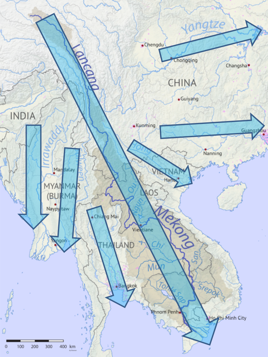
The Mekong River is the longest in Southeast Asia, flowing more than 4500 km from Tibet down to the South China Sea. It drops more than 15,000 feet and flows through China, Myanmar, Thailand, Cambodia, Laos, and Vietnam. The Mekong Delta is huge, flat, and very very wet.
As with all large river deltas, the weight of the accumulated sediment depresses the underlying Earth’s crust. The rate of crustal subsidence very closely matches the rate of new sediment accumulation at the surface, so that the land remains flat at sea level as many thousands of feet of mud accumulate below the water line.
The Mekong Delta is the most densely-populated and prosperous region in Vietnam, home to 17 million people (about 20% of the population). It’s directly adjacent to Ho Chi Minh City (formerly Saigon), a city of more than 13 million, and woven into the country’s urban finance, tech, and manufacturing sectors.
Annual floods during the Monsoon rains replenish the super-fertile topsoil with layers of nutrient-rich mud collected from the enormous upstream watershed. Just as the US Midwest is the nation’s “bread basket,” the Mekong Delta is the “Rice Bowl” of Vietnam, providing more than 50% of the nation’s carbohydrates and nearly 90% of rice exports. It also provides more than 60% of Vietnam’s fish and seafood and a huge harvest of fruits and vegetables.
The centrality of the Mekong Delta to Vietnam’s economy and cultural identity is very different from the social status of the outer bayous of Louisiana on the Mississippi Delta in the USA. Large wetlands in the US have long been a refuge for wildlife and marginalized people. I spent a summer working with students and community leaders in Houma Louisiana and learned about the tragedy of land loss due to mismanagement and neglect and levees and rising sea level. A central aspect of the delta disaster in southern Louisiana is the marginal social position of poor, disadvantages, and displaced people in the outer bayous.
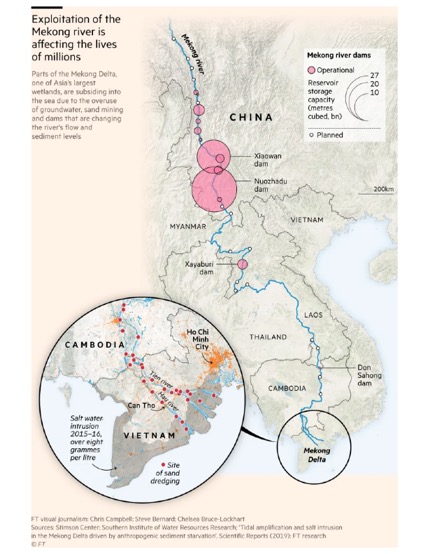
In the past 30 years, the economy of China has expanded twenty-fold. The Chinese have built dozens and dozens of huge hydroelectric dams in the Upper Mekong (called the Lancang there). Each reservoir traps sediment behind its dam and silts up quickly. Instead of the chocolate-colored mud which used to flow down into southeast Asia, cold clear water flows from the bottom of each reservoir. The clear water is hungry. It strips sediment from the river bed and eats river banks, flowing faster downstream to the next dam where the erosive power of the invigorated stream is renewed.
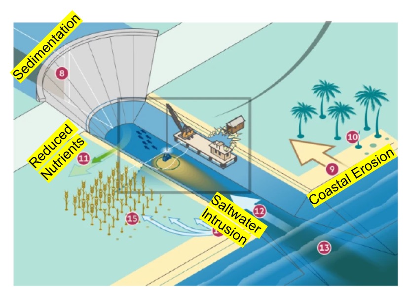
Starved of fresh sediment, the balance between gravitational subsidence and deposition on the delta has suddenly swung to the sinking side. Land that was rapidly aggrading into the sea is now sinking fast. The annual monsoon floods still inundate the land but no longer lay down anywhere near as much nutrient-rich silt in the wet rice farms that feed so many millions and provide export income.
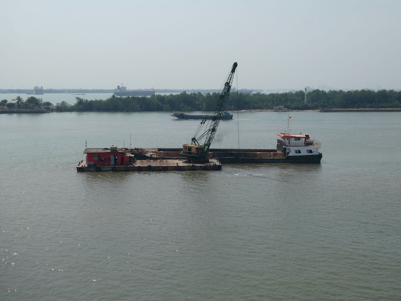
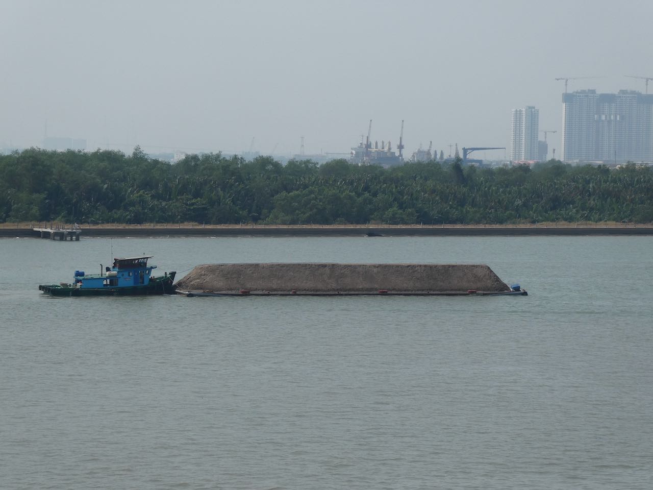
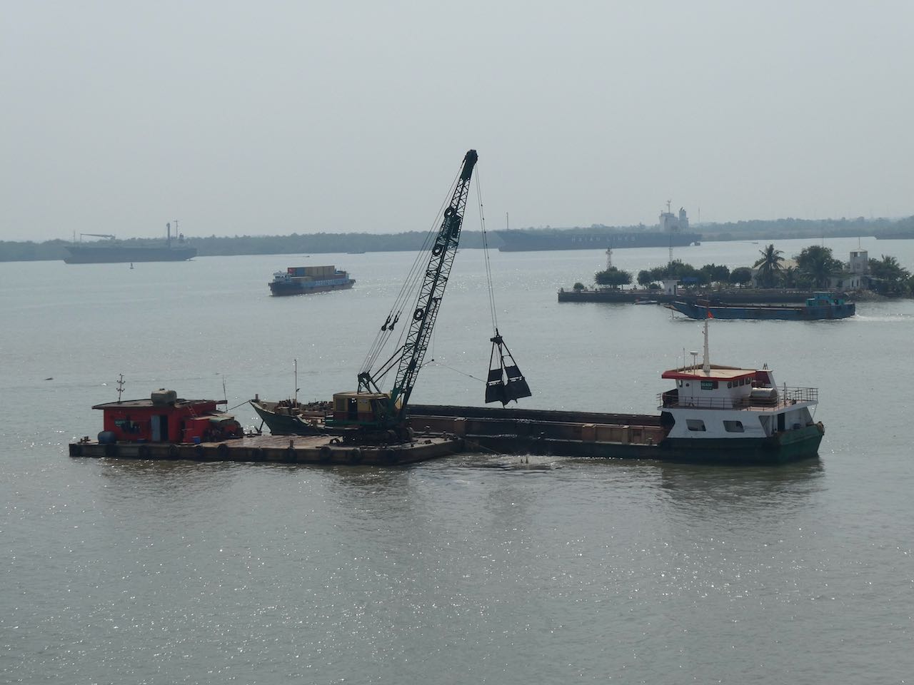
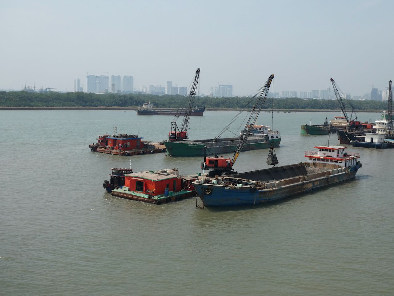
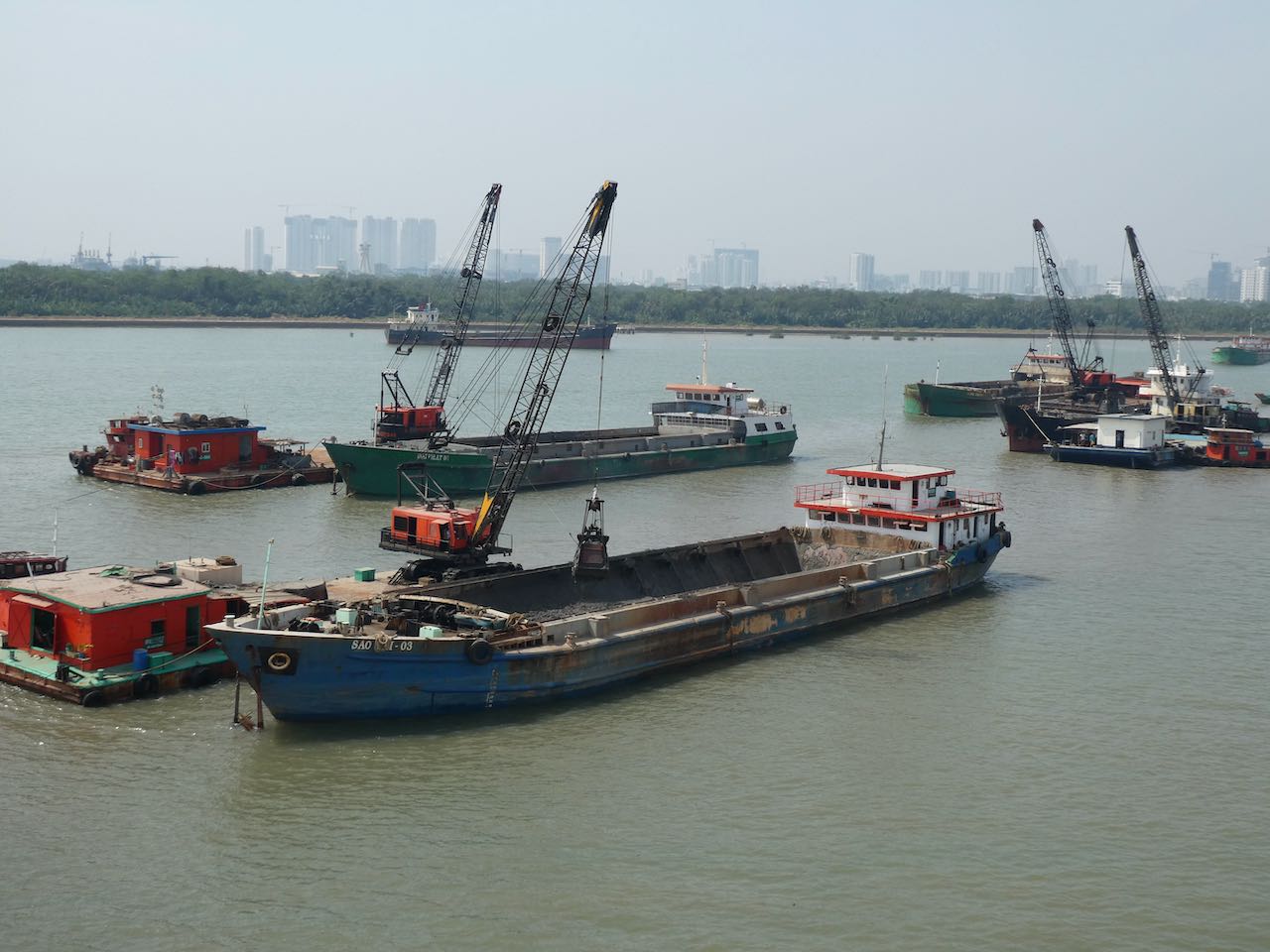
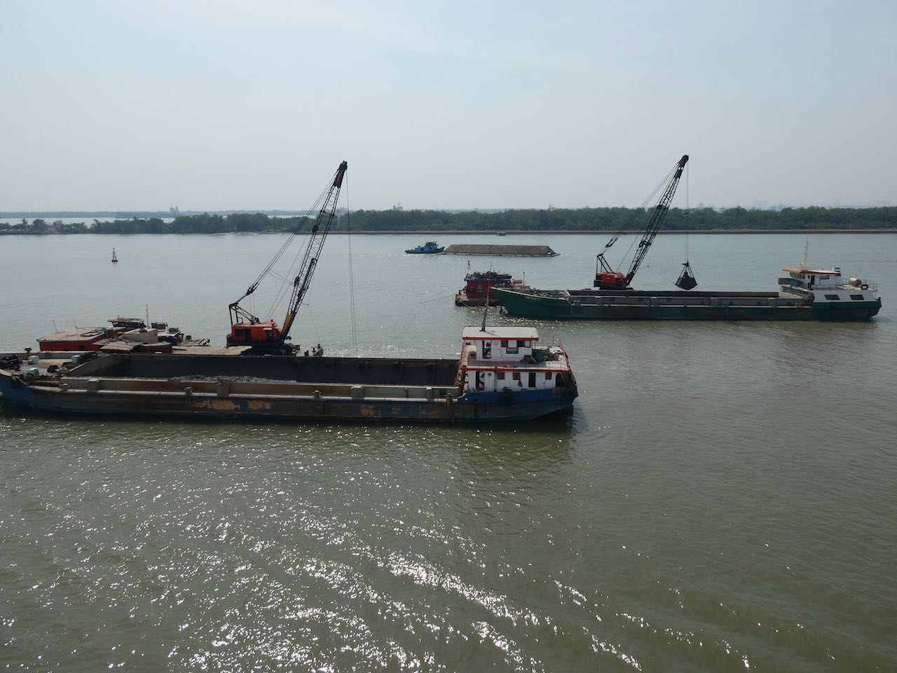
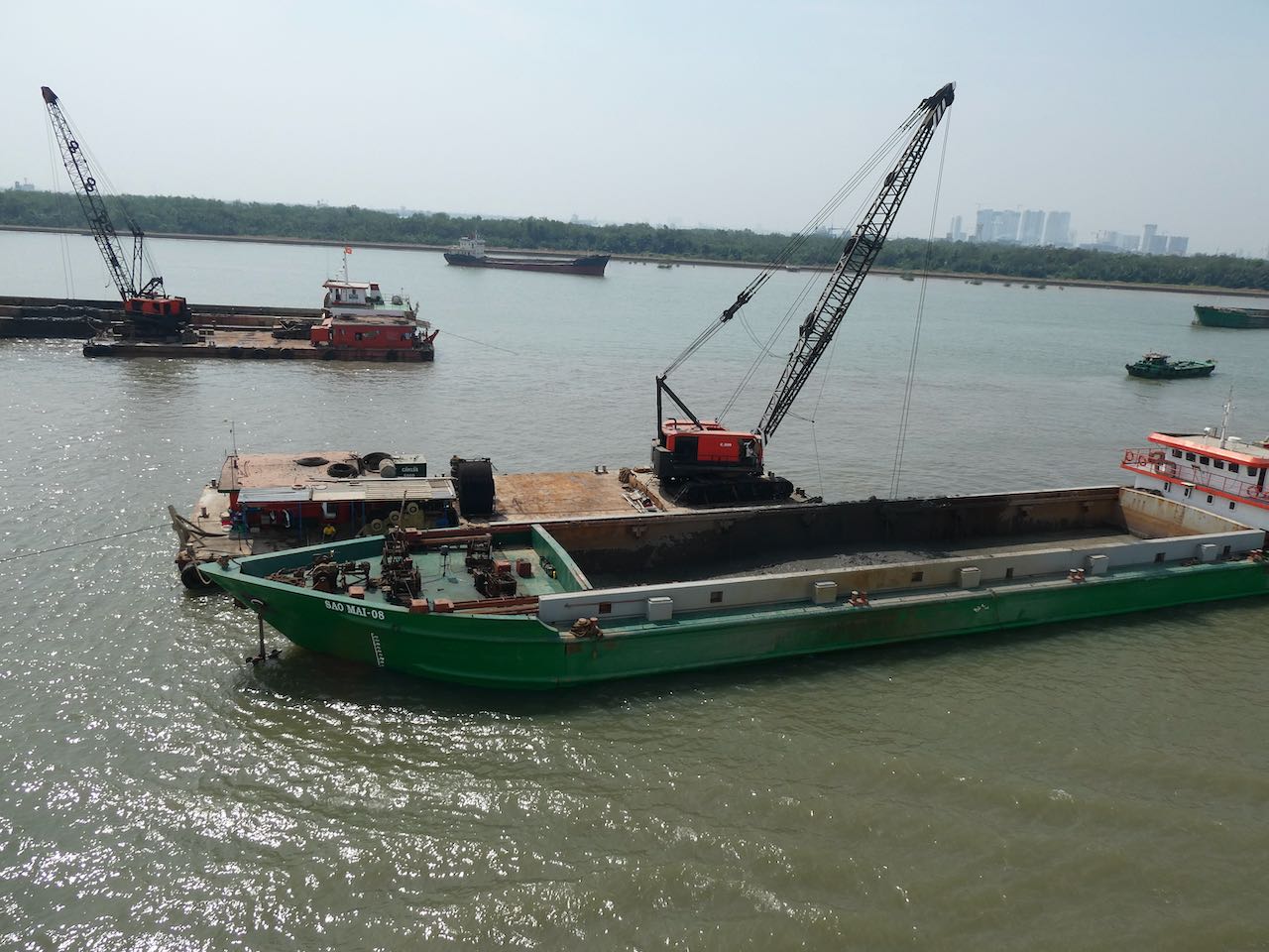
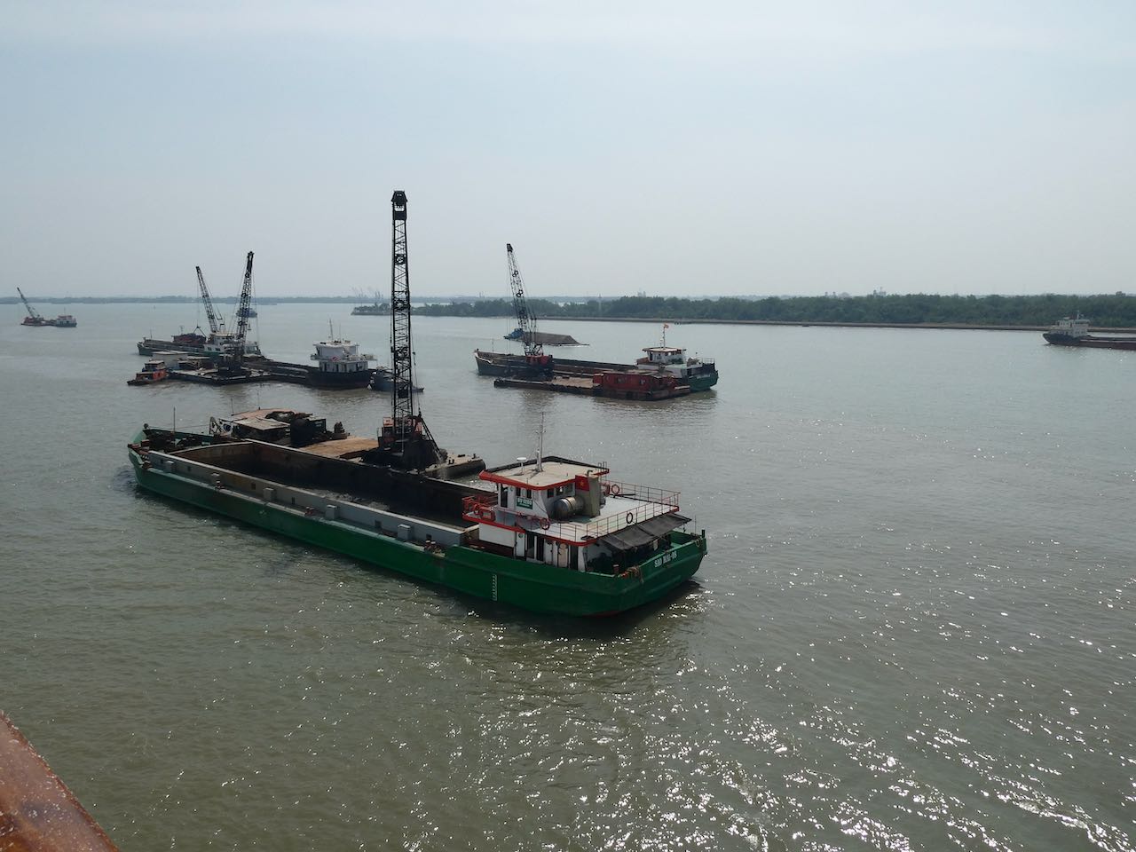
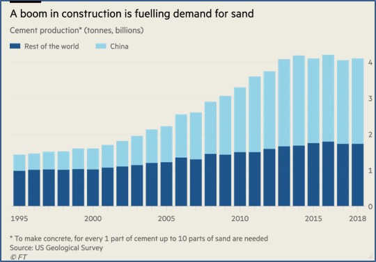
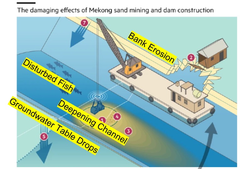
Worse, the demand for concrete by the voracious Chinese economy has led to massive dredging and mining operations that harvest sand from distributary river and stream channels across the delta. Purpose-built mining ships dig huge quantities of sediment from the bottom and dump it into fleets of waiting tub-shaped vessels where it is washed of fines and then loaded onto barges that look too top-heavy to be seaworthy.
Removal of sand from the river bottom accelerates the flow and makes the water even more hungry. Banks collapse into the channel. Saltwater penetrates further inland with the rising tide, poisoning the mangrove forests that hold the delta together. Fisheries are massively disturbed both by the dams that bar migration as well as the changing flows and water quality.
Vietnam is a country of water, water everywhere. The north from Hanoi on down to the sea is the Red River Delta. The south is dominated by the much larger Mekong Delta. The vast majority of the people live in the deltas. The culture is one of streams and wet rice and a huge watery buffer zone between the rivers and the sea.
But for the first time in millennia, the sea is taking land rather than giving it. Between the rising waters of the globe, the falling delta starved of sediment, and the hungry water flowing among the sand mines, the land is disappearing fast.